Crystal River and the Withlacoochee River Videos

Beach House and crew would like to share a couple of short videos taken as we cruised some of the rivers in the Big Bend section of the Florida Gulf coast.

This one is from the Gulf of Mexico, up the Crystal River to Kings Bay.


The Withlacooche River from the GOM approach Channel to Yankeetown.

Exploring Florida's Gulf Coast

For a couple of days, thunderstorms have rumbled all around us, keeping us from our next destination some 50 miles to the north. This isn't like the protected waterway; this time we need to cross the Gulf of Mexico from Steinhatchee to St. Marks. "How did you get to Steinhatchee, you were just in Fort Myers," you might ask? That's a good question and one we ask ourselves. The time seems to be flying by and we are covering a lot of ground, err, water. Up until a week ago, the weather was cooperating, the boat was running just fine after the repairs and all was right with the world. After Fort Myers, there were days when we only traveled 10 to 15 miles along the waterway. But that was by design.


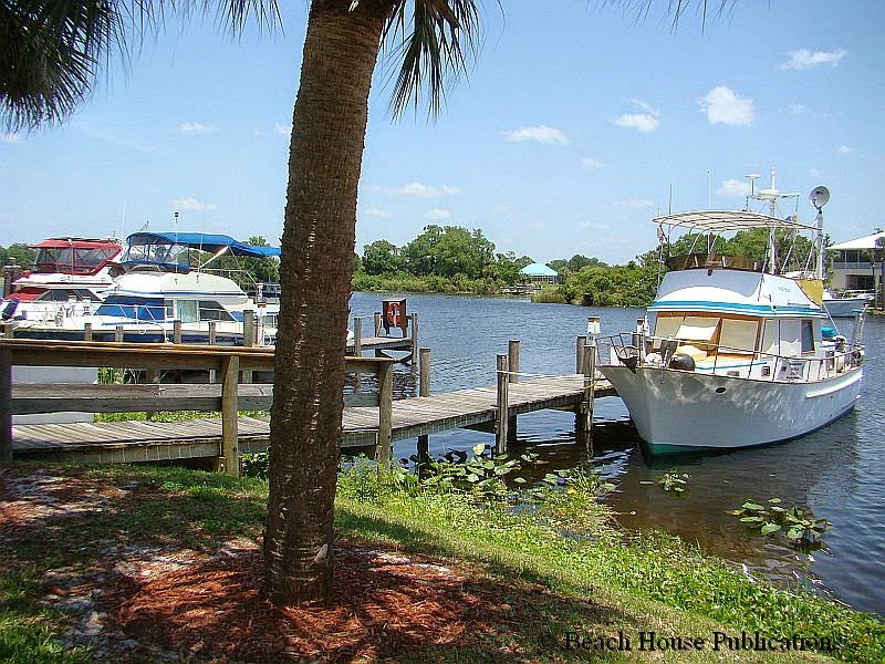
Once the engine repairs were done and appeared to be fine, we began the research of the Gulf Coast anchorages for the next book. This is always the fun part. Our process is pretty simple. We pick the areas we want to investigate the day before, cruise the approach and anchorage areas, making notes of depths for the approach, depths inside the anchorage, latitude and longitude, bottom types, wind and wave protection and dinghy landing places ashore. All of this is recorded in our log so that the info can be added to the book. Our stop for that first evening, but by no means our first anchorage to check, was in Pelican Bay at Cayo Costa State Park. We shared the anchorage with 16 other boats.


From Pelican Bay on, it became a blur of anchorages and free docks for what seemed like days. Beach House and crew made stops in Englewood Beach and Longboat Key. At Longboat we had a good visit with our friends that had kindly given us the use of their dock in Key Biscayne before we crossed to the Bahamas last year. From Longboat Key, after many, many more anchorage spots, we arrived on the Manatee River and spent some time in Bradenton. We anchored in the river, took advantage of the Bradenton free day dock to explore the city and spent a quiet and peaceful night in Terra Ceia Bay the next night. From there, Beach House and crew visited St. Petersburg and spent time in the city marina. Our first night on a mooring in Vinoy Basin was probably the most uncomfortable night since our anchorage at Highbourne in the Bahamas. Swells and waves worked into the basin from Tampa Bay and bounced off the surrounding seawalls, creating a very uncomfortable roll. The next day we moved into a marina slip so we could enjoy all that downtown St. Petersburg has to offer, as well as visiting with a former cruising buddy. Anchoring or mooring here in easterly winds is just not an option.


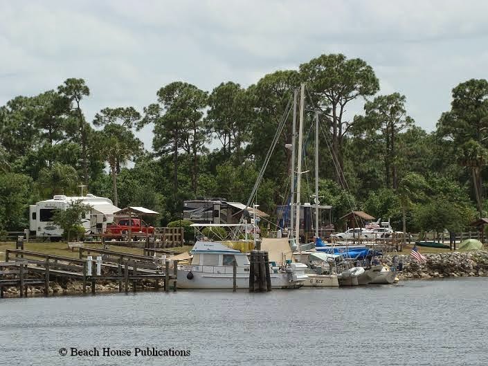
The next few days would find us in Gulfport. The funky beach side atmosphere we found made the stop in Gulfport a real treat. The downtown area is filled with quaint shops and some excellent restaurants. On Tuesday, there is a farmer market in the downtown area with many vendors. The anchorage off Gulfport is very large with many boats. It's exposed to weather and boat wakes, but there is a very nice floating dinghy dock inside the pier right in downtown. If a marina stop is required or desired, the Municipal Marina has a friendly staff and is well protected if bad weather is pending. It's only a short walk from the marina to downtown, about a mile. From Gulfport, we needed to do some very extensive research of Boca Ciega Bay. This would prove to be quite an undertaking since there are so many options for anchorages. The entire bay is a fabulous cruising ground and one could spend a week or more just in this area.

After anchoring for the night in Redington Shores, we then moved on to the Clearwater area. There's a great day dock just across from the beach that can be utilized until midnight. Then, just drop back across the channel and anchor. One particularly memorable location in this area was Caladesi State Park. The remote island is only accessible by boat and the protected marina basin offers relatively inexpensive slips with power available. Deeper draft boats might want to bypass Caladesi since the approach channel can be quite shallow at low tide (4 feet).


The next day took us to the town of Tarpon Springs. The only available anchorages are at Anclote Key and near the boat ramp and power plant at the entrance to the Anclote River. Farther upriver toward town, the water outside the channel is very shallow. Tarpon Springs does have several marinas so that boaters can visit the town and experience the Greek cuisine Tarpon Springs is famous for and visit the working sponging community. Maybe it was just the time of year, but on our visit we found very little activity in town, and the place seemed to be a little tired since our last visit several years ago. Leaving Tarpon Springs and heading north meant a jump out into the Gulf of Mexico to our next destination on the Crystal River. Weather now became very important in crossing the open Gulf. From past experience, we know all too well how even moderate conditions can create very uncomfortable conditions for a long trawler passage.


Our departure from Tarpon Springs at first light brought us the 70 miles to Kings Bay on the Crystal River by 3:30 in the afternoon. The crossing was excellent and the well-marked but winding channel into Crystal River made our arrival stress free and very pleasant. We planned to spend a week to visit relatives and take care of some doctors appointment that had been made months in advance. Our car was nearby for us to use, and the location just made everything convenient. It was good to just be in one place for a while and not have to move on. With our own transportation we shopped, visited family, explored and did all the things that are hard to do from a cruising boat while underway. Exploring Crystal River was fun, too, since this isn't a common cruising destination, although in our opinion it should be. Getting off the beaten path is our favorite thing to do.


From Crystal River, our next port of call was also off the well worn path. The Withlacoochee River was another 32 miles away by the time we went back down river, cross the Florida Barge Canal Channel and went up the Withlacoochee. This turned out to be one of our favorite places so far. The entire Big Bend area of Florida is not what most expect when visiting Florida. Locals refer to the area as "Old Florida" and with good reason. There are no major condo developments and no amusement parks, just small fishing towns without all the big crowds and high prices. The laid back atmosphere only adds to the natural beauty that seems to have been lost in much of the rest of the state. Beach House stayed at Riverside Marina in Yankeetown for almost another week and could have stayed much longer. The sheer beauty of the area both on the water and on land makes this one of the most peaceful places we have had the pleasure of visiting. Our relatives helped us pick up and move our car from Crystal River to the Withlacoochee, again, making getting around easy. Even though we had spent almost two weeks in this area, it went by too fast. Once again, we needed to move on.


The trip from the Withlacoochee River to Steinhatchee was our longest distance covered, 80 miles, in a very long time. This was all new territory for us since our last passage along this coast was done on our sailboat with a 6-foot draft. We wrongly believed that these rivers were too shallow to transit in a boat of that draft. Now we know that is just not correct and we could have done this trip with Sea Trek. All of the approach channels are far out into the Gulf, but all are well-marked and deep enough to allow the commercial shrimp boats to come and go as they please. Only a very few places would have given us any pause, even with a 6-foot draft, and with the exception of the 5-foot bar at the Crystal River entrance, would not have kept us out of the other rivers, even at low tide. We departed the Withlacoochee at 6:10 a.m. and dropped our hook in Steinhatchee at 4:30 p.m. after another very nice Gulf crossing. So far we had avoided the typical afternoon thunderstorms that are notorious this time of year. On recent passages along the Gulf Coast we had experienced very violent weather and now try hard to avoid that if at all possible. From the Steinhatchee, the plan is to head to St. Marks and begin exploration of the Florida panhandle and Alabama. So stay tuned for more and to get photos and up-to-date information on our current location, check our Facebook page and our Tracking Page on our website.

The Passing of Claiborne Young

Claiborne during a recent visit to Beach House
It is with a heavy heart and great sadness that we report the passing of our good friend Claiborne Young. Claiborne dies as the result of injuries sustained in a motorcycle accident on Saturday June 14th. The boating community has suffered a major loss. Very few boaters have not benefited from the contributions Claiborne has made over many years in the form of his excellent cruising guides covering the ICW from Virginia to Alabama and most recently from his website, Salty Southeast Cruiser's Net. His wife Karen died in October 2013 of what Claiborne called “never smoker’s lung cancer” and Claiborne seemed to recently start getting his life back on track. Just a few weeks ago he purchased a trawler and in an email to us a few days ago, wrote of how excited he was to get back on the water and explore the waters he knew so well. He was a true gentleman and someone that never had a harsh word to say about anyone or anything. He will be missed by so many. The following was taken from cruisersnet.net ...

Claiborne Sellars Young [1951-2014] passed away on Saturday evening, June 14, 2014 at UNC Hospital in Chapel Hill following a serious motorcycle accident. He passed into the arms of the Lord at 7:00 p.m. surrounded by family and friends.

Born and raised in Burlington, Claiborne lived there all of his life. He was a well loved, well respected man in all aspects of his life. He was a devoted husband, well-known boating author, speaker, and web publisher. He was also a generous, kind and loyal fellow to the many people who called him Friend. Claiborne will be mourned and missed by family, friends, associates, and fellow cruisers.

Claiborne was a graduate of Walter M. Williams High School in Burlington and NC State University in Raleigh. Following the closing of the Sellars family business in the early 80s, he turned to his next loves – water and boating – eventually authoring a series of books for the cruising community from North Carolina to Florida. His first book, the “Cruising Guide to North Carolina” was published in 1983. He also worked with UNC-TV [PBS] to produce a series of travel videos on the waters and small towns of North Carolina’s coast. More recently, Claiborne went on share his love and knowledge of all things water related and published a successful website dedicated to the boating community and boating legislation. Claiborne was loved by many friends within that community, and always had a place to stay and chat while traveling on his speaking engagements. Those who knew him, found that Claiborne was never at a loss for words!

At home, Claiborne was a loving and devoted husband for 40 years, a motorcycle enthusiast, and animal lover. During the years of their marriage, he and Karen were ardent supporters of the Alamance County Humane Society and the American Humane Society, and surrounded themselves with many four-legged friends. Claiborne was also a self-taught chef who was often found in the kitchen producing the most aromatic and tasty dishes. When Claiborne put on a spread, everyone was happy, full, and sated!

Claiborne was preceded in death by his wife Karen Williams Young who passed away October 2013, and his parents Claibourne Clark Young and Dorothy Sellars Young Brawley. He is survived by family from his Sellars and Young relations, as well as his Williams in-laws.

A service of remembrance will be held at Rich and Thompson Chapel in Burlington on Wednesday, June 18, at 11:00 a.m. with Dr. Genie Martin officiating.

Visitation will be Tuesday evening June 17 from 5:00 – 7:00 p.m. at Rich & Thompson in Burlington and other times at the Young’s home [814 Colonial Drive, Burlington].

In lieu of flowers, the family asks that memorials be made to Hospice of Alamance/Caswell, 914 Chapel Hill Road, Burlington, NC 27215.

Condolences may be offered at www.richandthompson.com.

If It's A Boat, It Will Break

If there is one thing that I am certain of after a half century of boating, it's that on a boat, something will break. A pesky oil leak in the front of the engine began as a minor thing and an annoyance. By the time we were halfway across the Okeechobee Waterway, the leak increased and since it was the front main oil seal, the belt pulley was starting to fling the oil as it spun. That meant oil was not only dripping under the engine, but slinging up on the engine room walls and everything else around it. Not a pleasant thought and definitely time to make repairs. Replacing the main seal is not a major repair, but it requires equipment most boaters don't carry on board. We knew a good mechanic from our time living in Port of the Islands near Marco Island, so a call to him arranged the repair when we arrived in Fort Myers. The parts were ordered from American Diesel and would arrive at about the same time as Beach House. All seemed to be set for a short stop and a quick fix. Ah, but this is a boat after all.


No sooner were we docked at Fort Myers Yacht Basin than a familiar face appeared on the dock to greet us. One of our neighbors from a short stop we made at Lamb's Marina near Elizabeth City, NC had moved their boat to Fort Myers and was a few slips down the dock. It's always good to see familiar faces when we arrive at a new place. A check at the marina office confirmed that the parts had arrived. We ordered a new front engine oil seal and the replacement gasket for the timing gear cover. The mechanic was lined up to arrive the next day to look over the situation and if all looked good, to make the repairs. Things were going according to plan and that worried us, a lot. But this is a boat after all. The other reason for this marina stop was to take care of some appointments that were made months ago and we needed to rent a car to get from Fort Myers to Gainesville, FL. Enterprise Car Rental in Fort Myers proved to be a little difficult at first, but we finally worked things out and hit the road.

The replacement of the front engine seal on a Ford Lehman 120 requires the removal of the wheel that contains the pulley for the engine belts. This is also known as the balancer. It has a tapered nut holding it on at about 200-foot pounds and requires an impact wrench to get it off. Once off, the plate on the front of the engine that covers the timing gear is removed and the front seal is pressed into that cover. While we were on the road, a call to the mechanic revealed that the repair was not going to be as simple as we anticipated. The timing gear cover had a crack in it and it was probably the crack that was leaking and not the seal. The mechanic planned to take it to a machine shop to see if the metal could be welded, but the location made that repair iffy. We might need to find a replacement cover. These engines are over 30 years old and sometimes finding parts can be problematic. A call to American Diesel resulted in some bad news. They did not have a replacement and had not had one in a long time. This is when we started to worry. There is another provider of parts for the Ford Lehman, and that is a company called Bomac in Georgia. What a relief it was to call them and find out that they had a replacement in stock and could ship it out immediately. During the course of all of this, the new seal was damaged and another was ordered with the cover. It would arrive overnight.

The parts went in the next evening and everything went back together without complication. Running the engine at the dock did not indicate any oil leaking. By now we had been at the marina a few days longer than anticipated and the crew was anxious to get underway again. The next morning the engine was run at the dock for a half hour just to make sure everything was okay, and it seemed so. But this is a boat after all. Dock lines were let go and with a little effort and help from the marina staff ̶we had a strong cross wind ̶Beach House eased out of the slip and continued out onto the Caloosahatchee River with plans to connect up to the Gulf Intracoastal Waterway. But first, we wanted to stop and investigate an anchorage a few miles away in Bimini Basin. Once the anchor was down, a check of the engine room showed the leak was not only back, but worse than before. Remember what I said earlier about boats. A call to our mechanic resulted in him offering to have us bring the boat to a dock behind his home to try and determine what happened. Since he lived nearby, we decided to spend the rest of the day and that night in Bimini Basin. We dinghied ashore to do some exploration and as we sat on a park bench near the anchorage, we spotted our friends cruising around Beach House in their small deckboat. We had just spent the evening before with them at their home for a lovely dinner.

It was a pleasant afternoon and evening, but the next day the problem with the leak had to be resolved once and for all. A short motor back up the river to the mechanic's dock didn't take much more than an hour, but when oil is leaking all over the front of the engine and being flung around, it can be a long hour. It wasn't enough oil loss to be of concern, just enough to make a mess. We tied to the dock behind the mechanic's home, but he was across the state working on another job and would not return until the evening. There was nothing to do but wait. When the parts were removed once again, it appeared as though the seal had failed. The only thing we could conclude was that it was a defective seal. Rather than ordering another from Bomac, the decision was made to order a new seal, plus a spare, from American Diesel. Any parts that came from them was always of high quality. Once again, the parts would arrive overnight and for the third time, a new seal would be installed.

Great care was taken to be sure the newest seal was installed properly. In order to do that, the seal must be properly pressed into the timing gear cover, taking care to make sure it's oriented properly. The cover is put in place with the many bolts that hold it on only loosely installed. Then the balancer is put in place until it is just barely seated in the seal. This lines the seal up and centers it on the balancer. The bolts for the cover are snugged up until all are snug, and then they are tightened as much as needed. And of course a new gasket for the cover was installed. Once the cover and seal are in place and everything is tight, the balancer is tightened down using an impact wrench. This time we ran the engine at the dock for over an hour at cruising RPMs. Once again, everything looked fine. But we have been fooled before. The following morning we left the dock and continued on our journey. Our next anchorage was only a couple of hours away just in case there was still a problem, but far enough to give the seal a workout. Hallelujah. After repeated checks of the engine room about every 30 minutes and another thorough check once the anchor was down, all looked fine. We could begin to breath a little easier, but it would still take a few days to feel confident things were finally resolved.

As the days progressed and no oil leaks were detected, confidence in the engine returned to normal. There are still hundreds of miles to cover as we make our way along the Gulf Coast researching our next edition of TheGreat Book Of Anchorages, The Gulf Coast, including the Okeechobee Waterway. Most days the boat will put in a full day of running, but the distance transited along the coast might only be about 10-15 miles. There are so many anchorages to research and explore that we zig and zag across the GIWW. There will be other days where 50 or 60 miles of the open Gulf of Mexico will be ahead of us as we cross the Big Bend region of Florida. Traveling alone on a boat with a single engine keeps us aware of the need to have everything in good working order. A breakdown miles out in the Gulf and a long distance from any help can be more than an inconvenience. Weather this time of year along the Florida coast also plays an important part in all of our decision making. It's already the rainy season and afternoon thunderstorms are becoming a fact of life. Some of these storms can be sudden and very violent. We need a boat and equipment we can count on, and we believe Beach House will not let us down. Let the adventure continue. Don't forget to visit us on Facebook to see lots more photos and the latest news.

Franklin Lock And Dam Campground And Marina

We recently visited the St. Lucie Park and had written about what a pleasant and unexpected gem it was. Imagine, then, our surprise at what we found at the WP Franklin Lock and Dam Park. It is the westernmost lock in the Okeechobee Waterway out of the 5 locks in the OWW. Initially we had thought we might go ahead through the lock and continue on to LaBelle. However, as we approached the lock, the wind began to gust and we decided it was time to call it a day. I had glanced over and realized that the docks were on the east side of the lock and not the west as I had originally thought. Also, they are tucked up in a protected basin and not right next to the river as the docks are at St. Lucie. We spun the boat around and headed for the docks.


A very nice gentleman, Walt Vliet, who was out for a few weeks cruise with his wife June, came to our aid as we docked with the wind blowing us up on the finger pier. No matter how many years of experience one has, it is still difficult to dock with a single engine and a good, stiff breeze on the beam. Once secure, we had the opportunity to visit with Walt and June. Both are about to turn 80 soon and have been cruising for years. They live in Hobe Sound and often travel back and forth across the Okeechobee on either their small sailboat or their Marine Trader trawler. They were a pleasure to meet.


But the real story is the park. It is truly a beautiful little place. The RV park and marina, situated on its own little island, is located on the northeast side of the river and lock. Slow speed buoys are located at the entrance to the marina basin. There are 8 slips here as there are at St. Lucie, with 4 being first-come, first-served and the other 4 able to be reserved. Very little wake makes it into the basin. Trees and a decent size picnic pavilion are very near the docks, and a short walk west past a number of RV sites, takes you to very clean heads and showers. Recycling bins are available just next to the trash.


In the middle of the island is the ranger’s office where you pay your dockage. (Again, the same as St. Lucie - $24 per dock including water and electric, or $12 if you have your Golden Age pass for those 62+.) Just next to the office the ranger’s trailer and little fenced in yard that houses her “babies,” three small dogs. From there, turn and walk due south out to the lock and fishing pier, or turn north to walk over the short causeway to get some exercise or a different view of the island. The other, or west, end of the island has many more RV sites and a larger head and shower facility which also houses a washer and dryer. You can walk beyond that building and find another large covered pavilion at the southern end as well as a bench with a great view to the west.


If the docks are full, no problem. Figure out which direction you need wind protection from. There is plenty of room to anchor in the east basin beyond the docks, then dinghy in to the boat ramp near the heads and showers. Or anchor in the basin on the west side of the locks tucked up near the causeway that leads over to the island for great easterly and southerly protection. On this side, dinghy into the beach near the large trees just behind the building that houses the heads. The ranger is happy to have you come ashore.


You cannot walk across the lock to the other side like you can at St. Lucie Park, so drop your dinghy in the water and visit the beach on the other side as well as the visitor center. The only downside we can see is there are no provisions nearby, so come well-stocked and enjoy this little piece of heaven.

The Okeechobee Waterway Revisited

It's been three years since our last cruise on the Okeechobee Waterway and this time we planned to do it a little differently. On our last crossing of the Lake, we took the direct route across or what is also known as Route 1. This time we planned to take Route 2, or the rim route as we traveled east to west. This trip was also work, since it was the beginning of our research for our fourth book in The Great Book Of Anchorage series and will cover the Okeechobee Waterway and the Gulf Coast from Cape Sable, FL to Mobile, AL. Most folks avoid the rim route because of the reputation for shallow water, but we know a little secret that will allow even deeper draft boats to use the rim route in all but extreme low water levels. Prior to any Lake crossing there are three things a boaters wants to know before starting at either the east or west end of the OWW. There is one place to find two pieces of the info you need and that is on the Corps of Engineers website - the lake level and lock restrictions. The third is weather information - the National Weather Service website for Lake Okeechobee can be found here.

Lake Okeechobee is a very large and shallow lake. A strong to moderate wind can develop a nasty chop and make crossing a very uncomfortable situation. The current lake levels are important for a boater to have to safely cross the Lake and that information can be found by clicking the link here. The page is updated daily, gives the overall Lake level and the lowest depths for the Route 1 or Route 2 crossing. The depths given are not the depths for the entire crossing but the shallowest depths anywhere along the route. It's important to know where those lower depths might be found to avoid running aground. There will be much more water on 98% of the trip than the lowest levels reported. The second thing a boater will want to know is if there are any delays or changes in the schedules of the five locks that have to be transited along the OWW. That information can be found by clicking the link here. Then the trip can begin and it's a trip we highly recommend. There is one other piece of information that is important to sailors. There is a height restriction that will keep sailboats with masts higher than 49 feet from using the waterway. Those boats with taller masts will have to go down the ICW and around through the Keys to get to the opposite coast.


The shallow areas can be found in two locations. If crossing directly across the lake, shallow sections are in the channel as you approach Clewiston. There is no way around this spot, so close attention to staying in the channel and your draft in comparison to lake levels is important. But the rim route offers an opportunity to cheat a little and avoid not only the shallow area crossing the lake, but the shallow area along the rim route. This might seem odd since the reported depths for the rim route are always substantially lower than route 1. But there is only a very short section of the rim route where this shallow water can be found and it is easy to bypass. Immediately after existing the Port Mayaca Lock, the marked channel for the rim route turns south. There the depths can be as little as 4 to 5 feet. Instead of turning into the channel, take a course straight out into the lake until the depth finder reads 9 to 10 feet. Turn south and head toward R "60" at Statute Mile 50 near Pahokee and depths will be at least 9 feet all the way. This is depends on the overall lake levels. If levels are normal, these are the average depths. Re-enter the rim route channel and except for a small section with 8 to 9 feet, depths from 12 to 20 feet can be found almost the entire way.


The rim route is much more interesting and offers the opportunity to find some excellent anchorages along the way. At Torry Island, near Statute Mile 61, there is a swing bridge that requires the bridge tender to walk out on the bridge and use a bar to turn the mechanism by hand which allows the bridge to be opened. Shortly past the bridge we found a fantastic anchorage in a kidney bean shaped basin known as South Bay with all-around protection. We shared the anchorage with a few fisherman that went home for the evening and several large gators that hung around all night. From there it was a short distance to Moore Haven and the first lock on the west side of the lake. In the small town of Moore Haven, there is an anchorage just before the lock in the old channel or a very inexpensive town marina on the canal right after the lock. From this point on westward, you are in the Caloosahatchee waterway system. After another 20 miles, the Ortona Lock is the next to be negotiated. Each of the locks are easy to transit. There are signs to announce the arrival point. From there a call to the Locktender on the VHF radio is required and you will get locking instructions. Once a green light appears at the lock entrance, you enter the lock and lines are dropped down to secure the bow and stern of the boat. The water is lowered or raised, depending on which direction you're going, and once the appropriate level is reached, the gates are opened and the boat is free to exit.


About 8 miles west of Ortona is the town of La Belle. The town has constructed docks adjoining the canal and they are free to boaters for a maximum of three days. There is power and water on the docks, also free, but the boat needs to be tied up so that you will be able to get off either on the bow or the stern. There are no finger piers, except two small ones with water depths of only a foot or two and no power or water. In the downtown area there is a restaurant, coffee house, playhouse, pizza shop and groceries, and other restaurants are only a short walk. The docks are first come, first served and during the busy season, can be full. At the time we were there, they were having problems with the power and it was not available at all of the slips. Someone from the city did come down to work on them and told us this has been an ongoing issue.


Beyond La Belle, the Caloosahatchee canal and river winds through residential and farm land. It's not unusual to see cows and horses standing along the banks watching your boat go by. At Statute Mile 122, we encountered the final lock westbound, WP Franklin Lock. Approaching the lock from the east, a basin on the north side leads to the docks at the marina and campground. Just as the marina at St. Lucie Lock, Franklin is part of the National Parks and offers the same $24.00 per night or $12.00 with a senior pass. This includes electric and power and is good for a maximum of two weeks. This would be our next and final stop on the Okeechobee Waterway before reaching Ft. Myers. A nagging oil leak on the front of the engine was getting progressively worse so a stop for repairs would be needed. We had already contacted a mechanic in the area and ordered the needed parts from American Diesel. The parts would arrive at the downtown marina about the same time that we would arrive. For now we planned to just enjoy the park at Franklin Lock.

St Lucie Lock and Dam Marina and Campground


The St. Lucie Lock and Dam is located a little more than 15 miles upriver from the “crossroads” at the St. Lucie Inlet, the Atlantic Intracoastal Waterway and the St. Lucie River. Approximately 10,000 vessels transit this lock every year and the majority of them are recreational vessels. The Locks are operated from 7 AM to 7 PM, seven days a week. It takes about 20 minutes on average for boats to lock through completely. Signs indicate the arrival point on both sides and the Lockmaster is contacted on VHF Channel 13. He will give instructions to wait for the green light before entering and the Captain can choose the side of the lock on which to tie. Lines are dropped from the lock walls to secure the boat at the bow and stern as the water levels are raised or lowered. The Lockmaster announces when it’s safe to proceed after the lock gates are opened.


Ride along as we transit the St. Lucie Lock.


Immediately after exiting the Lock heading westbound, boaters will see a series of finger piers on their port side with space for eight boats. The finger piers are short, but with some creative tie ups, boats up to 40 feet have used the facilities. The slips are also narrow, making it difficult for two boats with wide beams to tie up in the slip. But if you find the space acceptable, this can be an excellent stopover along the Okeechobee Waterway and an excellent value for transient dockage. Daily fees are $24.00, a flat fee, and include power and water. If you happen to be 62 or over, you are eligible for a Golden Age Passport, allowing you half price entry to any national park, including the St. Lucie Lock and Dam Park. It’s hard to beat $12 per night for dockage that includes power and water! The signs near the docks say that there is a 14 day maximum, but the park has allowed boaters to stay a month or more. Technically there are four slips that can be reserved in advance and four slips on a first-come, first-served basis. The Park Rangers don’t seem to enforce this and at the time we were there, everyone had just arrived and paid the fees with no problem. Some boaters from Stuart make this an annual trek to get away from the hustle and bustle of the town for a while.


The Park is located quite a distance from any kind of shopping or restaurants so without transportation, there is not much to do except rest and relax and maybe get caught up on a few boat projects. As luck would have it, a couple of the boaters there had vehicles and offered rides to anyone that needed one. The campers in the RVs and travel trailers were also a friendly bunch and could be a source for a ride into the shopping centers if needed.


The Park has clean restrooms for the use by the campers and the marina. Each restroom also has a shower. These are cleaned daily by the Park employees and we found everyone very friendly and helpful. A large pavilion with picnic tables, a fire pit and charcoal grills made for an excellent evening get together spot for the boaters and some of the campers. Every afternoon and evening several of us gathered to share drinks, snacks and swap stories. It’s surprising how much the boaters and the campers have in common. We enjoyed the comradery and solitude so much that we decided to stay for a week and take care of some errands. Enterprise Rent-A-Car will pick up and drop off at the Park if a car is needed.


There are several smaller pavilions around the Park, all with charcoal grills and picnic tables. Walking is our exercise of choice and the Park offers a number of walking trails. There is a walkway across the entire lock and spillway to the other side of the river, where more pavilions and walking trails are available. The view from the lock is pretty incredible - just be sure to be off the gates when they open and close for passing boats. All kinds of wildlife can be found around every corner. Hawks, eagles and osprey soar overhead and the gators lounge in the sun along the banks of the river. You might even find a few snakes along the trail, so be ready for just about anything. A good insect repellent comes in handy for those times when the wind drops off and the little pests come out to feed. At the opposite end of the lock on the same side as the campground is a small visitor center. There are exhibits on the wildlife and history of the lock, and videos with interesting information. The Ranger at the center can answer any questions and they post the Lake levels daily from the Corps of Engineers website. We thoroughly enjoyed our time there and looked forward to getting to the park at the W.P. Franklin Lock on the other side of the Lake and farther across the Okeechobee Waterway. The Park there offers the same services. But that’s a story for another time.

Warning on Caframo Fans

We don't have enough information yet to determine if our experience with the Caframo 747 fans are just an isolated case that only we have experienced, or whether this is a problem with other fans of the same model. On both our Mariner 40 ketch, Sea Trek and now our Marine Trader trawler Beach House, the Caframo 747 model fans have been our preference for many years. The fans use the least amount of power, are the quietest and move the most volume of air of any other fans we have used. The fan is mounted using the more permanent mount and hard wired into a circuit breaker. The circuit breaker did not trip. As full time cruisers, improving the air flow inside the cabin is very important. In the last year, we have had two failures that have given us serious concern. Just over a year ago, one of the fans, which is mounted in our main salon near the lower helm station, suddenly began smoking and the body of the fan became very hot. Fortunately, we were able to shut off the power immediately and no harm was done other than evacuating the smoke. A replacement fan lasted about a year when we noted the smell of electrical burning and immediately determined that it was the replacement fan. The second time there was no smoke, but perhaps that was because we quickly shut off the power. Our concern is what might have happened if the fans were running and we were off the boat, even for a short period of time. Usually all fans, etc. are turned off when we leave the boat for any period of time, but not if we step off the boat for short periods, like talking to neighbors or taking out the trash. We now worry about these fans and whether we should consider another manufacturer in light of our experience. We have contacted Caframo about the issue, but as of yet, have had no response. We would very much like to hear from anyone else that has had issues with this specific product.

Update May 20, 2014


We have finally received a reply from Caframo. They have offered to replace one of the fans but did not address the question of why they might smoke and overheat even if not seized. One of the fans did slow down a bit but the other seemed to run at normal speed. Here is the reply... 

Dear Mr. Baier,

I am sorry for the bad experience you had with the Caframo model 747 fans. Please be assured that we take these issues seriously.

With your fans we only us special Fire Retardant grade plastic for the housing so that should the motor seize there is not risk of fire. However, with older units, should a motor seize heat can get sufficient to cause some smoke and smell.

Our new fans have added thermal protection so that should the blade get jammed or the motor seize current will be cut off to the unit ensuring all components keep at low temperatures. We will gladly send you a new unit at no charge. Please confirm your postal address and I will arrange for a unit to be sent to you.

Sincerely, Mike Tettenborn

Friends And Free Docks

One of the benefits of cruising as a couple for over 20 years is the fact that we have met some wonderful people and made many friends for life. Whether traveling by land or sea, we can't travel very far without needing to stop and visit with one of those friends. And Lord help us if we travel past and fail to visit. Many of our friends are former cruisers that are now land dwellers and some are still into the live-aboard lifestyle. So we would still have a few more friends to visit on this transit of the ICW. But the next day would be for just cruising and relaxing at our next destination, the free town docks at New Smyrna Beach.


Leaving Palm Coast, the waterway is a narrow channel until near the L.B. Knox Bridge. Here, the channel widens into the Halifax River towards Ormond Beach and Daytona. Near statute mile 840, the currents are dictated by the Ponce de Leon Inlet at New Smyrna Beach. This is a busy stretch of waterway with many marinas and a lot of boat traffic. The New Smyrna Beach town docks are on the mainland side just north of the 65-foot Harris Saxon Bridge. The docks consist of two near semi-circular fixed docks that adjoin a nice park. This makes docking a bit of a challenge. There is only room for two large boats or three medium size boats on each dock. At the time we arrived, a "Relay For Life" event was going on in the park and everyone we met was friendly and welcoming. Previously there had been signs on the docks saying "no overnight docking," but none were in sight when we arrived and two other boats were already docked there. No one said anything to us about a time limit.


The historic downtown area of New Smyrna Beach is a short block away. The town was busy and the main street was lined with shops, boutiques and restaurants with lots of different options for dining. The park at the docks has walking trails, a promenade along the waterfront, public restrooms and picnic areas. On Saturdays, there is a small farmers market in downtown with vendors selling fresh produce and local items. The Post Office is a short walk away, but there is no place to buy supplies or groceries without transportation. After spending the night and a quick trip to the Farmers Market, Beach House and crew continued the trek south on the waterway. After all, we had a friend to visit in Titusville.


The trip along the Mosquito Lagoon is always interesting. The channel is narrow, albeit well-marked, and the depth in most of this very wide body of water is only a foot or two for the most part. A strong cross wind can quickly put a boat out of the channel, so the best advise is to keep a watch on the channel markers behind the boat to get a better perspective of just where the boat is in relation to the channel markers. Soon the channel makes a turn into the Haulover Canal. This narrow canal is almost always full of small boats fishing along the sides and even in the channel. The canal is also a manatee hangout so care needs to be used at all times, and the entire length is a slow speed, no wake zone. The drawbridge that spans the canal opens on demand so delays are rare. Once through the canal, the Indian River stretches wide and long, and as the winds began to build, the river became very choppy. Fortunately, the wind and chop was coming on our stern so the ride was fine, until it came time to dock at the Titusville Municipal Marina.


This would be the second time we would have to squeeze into a slip here with 20 knots of wind on our beam. The fairway is barely wide enough to match the length of our boat, and the slips consist of two outer pilings with a very short finger pier. This means coming in on an angle at a pretty fast speed, getting the boat straight in the slip and then stopping before we come crashing into the main dock. Usually everyone on the dock and on our boat has some seriously tight sphincters until we finally come to rest with no damage to boat dock or neighbors. It does get the adrenalin pumping and is one of those times we would love to have a bow thruster or at least twin engines for maneuvering. Somehow we manage to come through unscathed. Thank goodness for lots of experience. The marina tends to put transients on this dock. It is the only dock open to the entrance and the swells roll in when the wind is out of the east. Our visit went well and too soon we pushed farther south.


From Titusville, the trip south on the Indian River can be bumpy under the wrong conditions. This would be one of those days. The strong wind was forward of the beam all day and spray swept over the boat on a regular basis. We violated two of our own traveling rules, not to be on the water on a weekend and not to travel when winds are forecast to be 20 or higher. Since this was a Sunday, we had hundreds of small boats zipping around at full speed and coming at us from every direction. By the end of the day, it was a big relief to have the anchor down in a fairly remote spot, and with the sun going down soon, the weekenders would all go home. We had left the docks at 0830 that morning and arrived at our destination anchorage just south of the Wabasso Bridge by 1730. On this night we would be the only boat in this anchorage, which was fine with us.


Passing under the Wabasso Bridge heading south, turn immediately to starboard and you will find water depths of 10 feet almost to shore. There is a dock for the Environmental Laboratory that sticks out into the waterway and we anchored between the dock and the bridge. Near the bridge is a small sandy spot that can be used to land a dinghy if the pets need to go ashore. The anchorage is just out of the waterway channel, but there was not any boat traffic after dark and even the bridge had very little traffic noise after the sun went down. Wind protection is good from every direction and that was a good thing since the winds had steadily increased all day. After some relaxing time on the flybridge, we retired for dinner and a good nights' sleep. The winds for the next couple of days were forecast to increase and switch direction so they would be right on our nose all the way to Stuart, our next stop.


Every once in a while the Weather Service gets it right. When the forecast called for 20 to 25 knots out of the south, we were not terribly excited to be getting underway. This was expected for days so sitting it out was not an option. The Indian River is wide and open to wind so it isn't like there would be any protection. Even a dawn start to try and make time before the winds built during the day didn't work. Within an hour of getting underway it was already blowing 10 to 15, and by 9:00 a.m. had reached 20. A boat underway has to factor in wind direction, boat speed and boat direction to come up with the apparent wind. We were not traveling at maximum speed, but were making about 7 knots. Once the winds blowing on our nose reached 20 knots and we added our boat speed to that, we had apparent winds of 27 knots. Now everyone knows that the winds don't blow at a constant speed, so in gusts, this would be even higher. And so it went from the Wabasso Bridge until we made the turn at the Crossroads for the ICW and the St. Lucie River. Sailboats heading north were having a glorious sail under headsail alone.


The Crossroads is another area of the ICW that shoals often and is constant need of dredging. Fortunately, the St. Lucie Inlet and the Crossroads had just been dredged, and other than watching to be sure the strong currents and wind didn't push us out of the channel, the depths were just fine, and the turn up the St. Lucie River was a non-event. Our stop here in Stuart was another visit to see our long-time friends that we had met the first time on a Bahamas crossing some 20 years ago. They now live in a townhouse community that has its own docks, and the dock right next to their beautiful Krogen trawler was available for us to use for a day or two. It was nice to be in a well-protected creek and tied to a dock by the end of this day. It's also always good to see old friends, and a dinner out sure helped to relieve the stress of a long day pounding into wind and waves. Actually the waves weren't too bad considering. Once again, the visit was all too short, mostly because we were under a rare time schedule to keep appointments that had been made months before. We were also looking forward to making another crossing of the Okeechobee Waterway and exploring some places we have not been before or for a long time.

You Can Follow Along

All of our friends and followers can keep track of our locations in almost real time. For quite awhile, Beach House has been using the Argus Survice Engineering (spelled correctly) on-board sensor platform for recording depth data as we travel along the waterways. This data is uploaded to Argus computers at the end of each day. Beach House is just one of many commercial and pleasure vessels equipped with the Argus systems. You can follow along with our progress by visiting our page on the Argus website, http://argus.survice.com/vessel_tracking/images/trackline-MarinaLife.html  and moving the map around. Clicking on one of the bubbles along our track will bring up depth and other information. This can also be a good resource for finding data collected from other participants by visiting the Solution Set page, http://argus.survice.com/argus_sample_data.asp . This data can be one more resource in your safe navigation arsenal. Have a safe boating season.

For you Facebook users, visit our Facebook page for lots of photos of these places and news updates of the waterways.